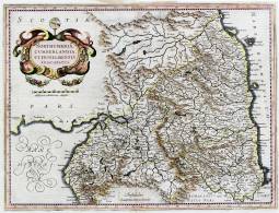
Full catalogue record

Title:Northumbria, Cumberlandia, et Dunelmensis episcopatus.Click on this image for zoomable version: Image name = m0146t.jpg    m0146
Creator (as stated on item):[By G. Mercator]
Place of publication: Amstelodami
Other publication given: sumptibus Henrici Hondij
Date of publication: [1636]MMM
Contents description: map of Northumberland, Cumberland and Durham county, showing towns, villages, parks and castles, rivers and hills, but not roads. The Roman Wall is shown. County boundaries, parks and hills coloured. Title in a cartouche... Descriptive text on verso in English. Bar scale unit described on map as 'Milliaria mediocriae Anglicae'.
From G. Mercator and J. Hondius, Atlas or a geographicke description... of the world (Amsterdam, H. Hondius & J. Jansson, 1636). Reprint of Mercator's map first published in 1595, with new cartouche and scale, Mercator's signature deleted, and sea shading removed.
Scale indeterminable
Additional scale information: [Scale bar: 3 1/8 in. = 20 miles]
Quantity/type of material: 1 map
Size: 33 x 45 cm
Other informationhand col.
Published description: Koeman ME 41. A, no. 7; Skelton (1970) p. 220-22; Turner (1960) 15b (Bibliography)

Copies held (with reference number and copy specific notes)
Please note that when a print occurs in a published book, only one occurence of that book amongst the partners is recorded. Other copies may exist, and can be located via the book catalogue for the institution. This does not apply to albums or to loose copies, where each instance of the print is given.
Repository/reference number:DUL NSR Planfile C 20/4

Repository/reference number:DUL NSR Planfile C 25/5/2

Index Terms
People
Creator:Mercator, Gerhard, 1512-1594
Other contributor:Hondius, Jodocus, 1563-1612
Places
Durham (England : County) - Maps, General - 159-
Northumberland (England) - Maps - 159-
Cumberland (England) - Maps - 159-

Link to project home page     Timestamp: 28/03/2024 11:26:51     Record number: 83